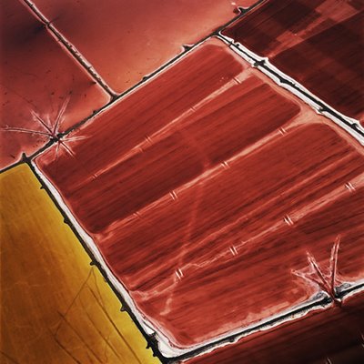
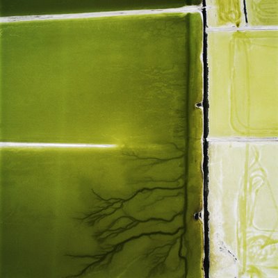
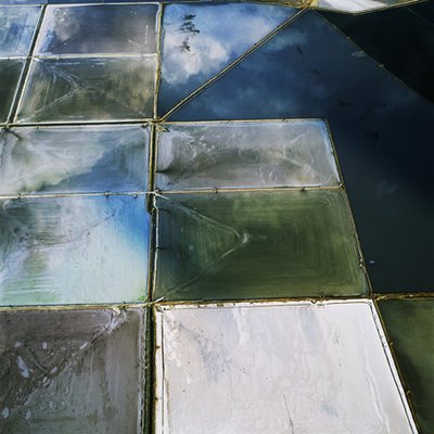
 I et langt intervju med Geoff Manaugh fra Archinect.com beskriver David Maisel sitt fotografiske ståsted som "fascination with the undoing of the landscape." Så er da Maisel også mest kjent for sine spesielle landskapsbilder, som inkluderer serier som North American mines, clear-cut forests, urban sprawl, samt Great Salt Lake.
In the era of Google Earth, TerraServer, and the like, aerial imagery is both extremely popularity and the subject of intense academic interest. /../ What do you think of this growing popularity of the aerial image?
The aerial view has certainly become, in our lifetimes, increasingly normative. The impulse is to assume that we understand or know something concrete about a place because we?ve seen a photograph of it, whether aerial or otherwise. I don?t necessarily subscribe to that theory; information can be just that, dumb and inert: it needs tools of interpretation and discernment and judgment in order to have meaning. ?Definitive meaning,? as such, is a slippery slope indeed. In fact, the slope is steeper and more treacherous now as the sheer quantity of information (from Google Earth, TerraServer, etc.) grows.
To see a photograph of a thing is to see a picture of that thing, an interpretation of it, whether by the photographer, the remote satellite camera, or the viewer. The same aerial photograph of a flooded New Orleans may be interpreted quite differently by a hydraulic engineer, a former resident of that city, a member of Congress, or a pastor. There are multiple truths in images, but too frequently singular truths are ascribed to them.
I should add that I don?t think of my work as aerial photography, or of as myself as an aerial photographer per se; it is simply a tool that I use in order to make the pictures that I want to make.
That being said, I still recall first seeing the image of Earth that astronauts had taken from space ? that sense of a fragile blue/green ball surrounded by blackness. I?m interested in the lasting strength of such an image.


David Maisel, from Terminal Mirage
Archinect.com - David Maisel
Ingen kommentarer:
Legg inn en kommentar